


Automatic boresight feature for improved georeferencing
Works with OxTS GeoCloud georeferencing software Produce stunning point clouds (PCD / LAS format) from a Velodyne LiDAR scanner using an xNAV and the OxTS GeoCloud georeferencing suite.
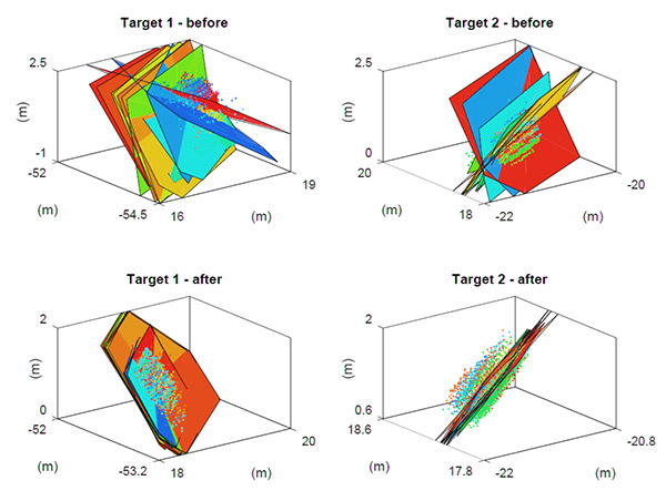
Aligning LiDAR and INS for maximum point cloud accuracy
GeoCloud includes a boresight alignment tool to achieve more accurate point clouds. This tool automatically aligns the LiDAR and INS reference frames using a proprietary algorithm analysing returns from two planar targets to find the precise alignment.
accuracy and reduce work-load
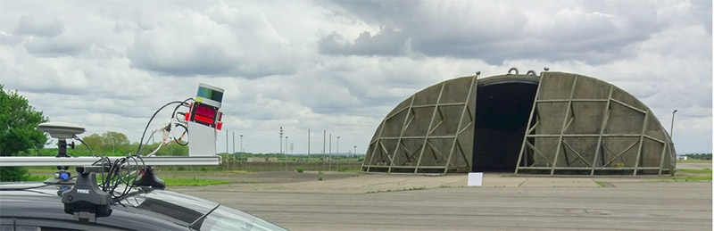
As well as saving time and reducing user work-load, the target-based system has been designed from the outset to be portable and simple to use in real-world applications. Two retro-reflective targets are arbitrarily placed on the ground (with no surveying required) and the vehicle is driven around these, during which time all the data required for boresight alignment is captured.
To learn more about how the Boresight Calibration feature in GeoCloud saves time and improves accuracy, learn more