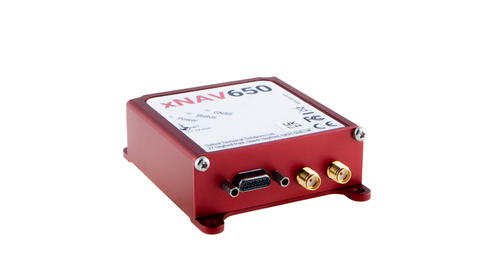


xNAV650 INS - The smallest, high-performance INS for survey and mapping applications
The xNAV650 provides surveyors with reliable and precise navigation data in tough GNSS conditions such as urban canyons. The compact housing is ideal for UAV and Drone-based surveys, allowing you to confidently create highly accurate georeferenced point clouds with centimeter-level accuracy.
The inertial measurements produced by the xNAV650 can be integrated with the raw data from almost any LiDAR sensor used such as the Velodyne, Ouster, Zoller + Fröhlich and Hesai, when using the OxTS Geopreferencer software.
The small, lightweight INS weighs just 130 g and measures only 77 mm x 63 mm x 24 mm.
Selling points
- Quad constellation
- gx/ix™
- GNSS/INS tight coupling technology for accurate measurements in all conditions
- Tactical-grade ITAR free IMU protects against GNSS signal dropout
- Supported sensor integrations
- Comprehensive OxTS NAVsuite software package included
- Affordable INS
Applications
- Road Survey
- Coastal Monitoring
- Construction Monitoring
- Geographical Surveying
- Infrastructure Exploration
- Building Survey (BIM)
- City Survey
- Forestry Survey
- Rail Survey
Precision and Accuracy
- 0.1° Heading accuracy
- 0.3° Roll/Pitch (PPK)
- 00.15 m Position Accuracy (PPK)